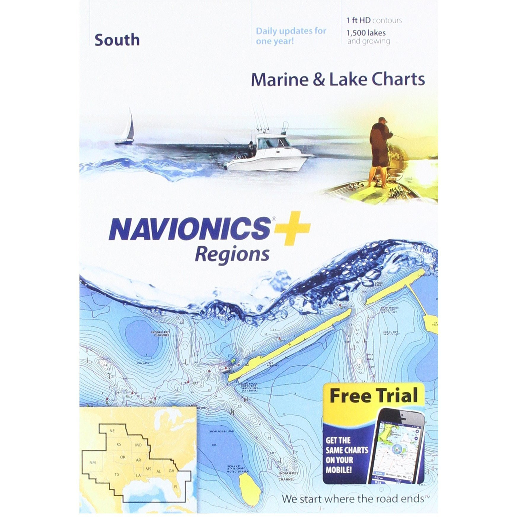
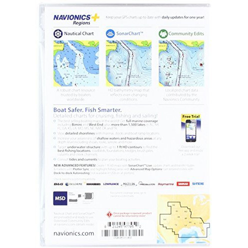
View Detailed Shorelines With Marinas, Docks And Boat Ramp Locations. Increase Your Awareness Of Shallow Waters And Hazardous Areas At Any Depth Level Including Shoals, Rocks, Wrecks And More. Consult Tides And Currents. Fish Smarter With Up To 1 Foot Hd Contours. You Will Find The Best Fishing Spots With Roadbeds, Foundations, Bridges, Brush Piles, Culverts And Creek Channels. Enhance Your Favorite Areas. Sonarcharttm Becomes More Precise Every Day With Sonar Logs Contributed By The Navionics Community From All Major Plotter/Sonar Brands And Mobile Devices. And With Sonarcharttm Live, You Can Create Real Time Personal 1 Foot Hd Bathymetry Maps On Your Plotter Or Mobile And Upload Sonar Logs To Navionics. Navionics Charts Are Updated With Around 2,000 Edits Per Day. You Will Have The Latest Nautical Chart, Sonarcharttm And Community Edits Enriched With Information From Official Sources, Our Own Surveys And Research, And Contributions From Fellow Boaters. Additional Features Including Plotter Sync, Dock To Dock Autorouting, Sonarchart Live Display On Plotter And Advanced Map Options Are Available With Select Raymarine Models. Nautical Chart And Sonarchart Are Preloaded And Ready To Use. Download Daily Chart Updates And Community Edits For One Year.
Actual product packaging and materials may contain more and/or different information than that shown on our website. We recommend that you do not solely rely on the information presented and that you always read labels, warnings, and directions before using or consuming a product.
For additional information about a product, please contact the manufacturer. Content on this site is for reference purposes and is not intended to substitute for advice given by a physician, pharmacist, or other licensed health-care professional. ZiFiti does not assume liability for inaccuracies or misstatements about products.
Statements regarding dietary supplements have not been evaluated by the FDA and are not intended to diagnose, treat, cure, or prevent any disease or health condition.


")


")